Search:
Corfe Castle
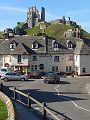
The northern edge of the Isle of Purbeck is demarked by a high chalk ridge that runs from one point on the coast at Flowers Barrow in the west, across to a second point on the coast at Ballard Down in the east. Approximately midway along this ridge – at Corfe Castle – is the one natural breach where two gaps cut by rivers left a mound that was to become the perfect location for a castle.
|
|
|
|
|
|
|
|
|
|
|
To view any image full size - simply click on the thumbnail
| ||||
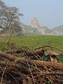
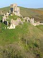
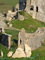
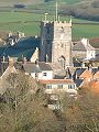
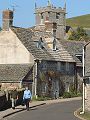
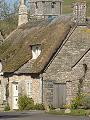
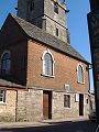
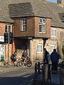
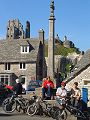
The castle remains that can be seen today date mostly from the 11th–13th century. The castle was deliberately slighted in 1646, when its royalist occupants lost out to the parliamentarian attackers. To the south of the castle lies Corfe Castle village (seen here in late March) which derived much of its prosperity from the stone trade – Purbeck stone and marble hewn from the many quarries to the south.
Find out more ... |
|
In the top row of pictures:
In the bottom row of pictures:
Corfe Castle also features in the monthly gallery February 2003 Nearby locations that also feature in galleries on this site:
More views of Dorset in March Other sites on the webPurbeck District Council: events, facts, links and accommodation The National Trust: visitor information for Corfe Castle The Dorset Page: Corfe Castle – local information and links to further resources on the web Maps of the area on streetmap.co.uk: 1:50,000 – detail, 1:250,000 – locality and route to get there
|