Search:
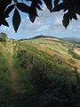
Tyneham and Worbarrow
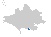
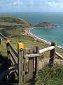
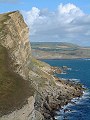
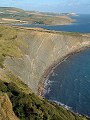
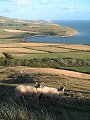
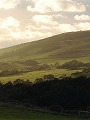
A popular walk along the Purbeck coast, here seen on a late afternoon (15:00 start) in September. The walk itself starts above the Army ranges on Creech Hill (SY 904 818) then follows the ridge westwards to Flower's Barrow (SY 865 804). From Flower's Barrow the route then drops southwards to sea-level into Worbarrow Bay (SY 871 798). Following the road eastwards and inland up the valley, the next stop is at the deserted village of Tyneham. The route then ascends onto the coastal cliff up to Tyneham Cap (SY 893 796) and continues eastwards along the ridge to above Kimmeridge Bay (SY 908 802) before finally turning back northwards to the start point.
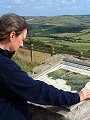
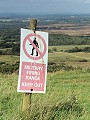
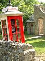
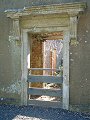
Tyneham was evacuated in 1943, when the Army took over this area for its training, they still practice there now. Most of the village is derelict, only the church and the old school (which now is open as an exhibition centre) are still fully intact. Access to this part of the coast (Lulworth–Kimmeridge) is restricted, the walks are however normally open during school holidays and most weekends of the year, for the rest of the year it is strictly off-limits (see below for links to sites giving access dates).
|
|
|
|
|
|
|
|
|
|
|
To view any image full size - simply click on the thumbnail
| ||||
Find out more ... |
|
In the top row of pictures:
In the bottom row of pictures:
Nearby locations that also feature in galleries on this site:
More views of Dorset in September Other sites on the webIf you intend to walk along the coast between Lulworth Cove and Kimmeridge then check the Defence Estates web page first for details regarding access to this part of the coast. Bovington Tank Museum: find out more about the history of the tank and other armoured fighting vehicles The coastline shown here forms part of the Jurassic Coast World Heritage Site West's Geology Field Guide to the Lulworth and Worbarrow area The Dorset Page: Tyneham, Worbarrow, Kimmeridge – local information and links to further resources on the web Maps of the area on streetmap.co.uk: 1:50,000 – detail, 1:250,000 – locality and route to get there
|