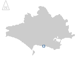
location where the photographs were taken
find out morefind out more

  Search:

Lulworth

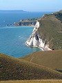
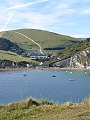
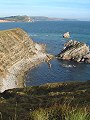
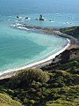
A popular tourist destination, Lulworth Cove is a small bay formed by wave action eroding away the soft chalky rocks that lie behind a band of harder limestones that form the bay mouth.

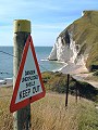
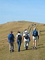
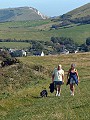
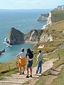
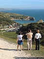
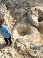
The pictures shown here are from late September and follow the coastal path westwards along the cliff edges from Flowers Barrow (SY 865 805) down to Arish Mell and over Bindon Hill, past West Lulworth to Hambury Tout (SY 816 803). The route then returned via Lulworth Cove, the Fossil Forest (SY 830 797), Mupe Rocks and Mupe Bay. Much of the route is across Army ranges and access is only possible on certain days of the year, it is also restricted to a narrow but clearly marked path. Follow the links below for access details.


006-01 Lulworth 006-02 Lulworth 006-03 Lulworth 006-04 Lulworth 006-05 Lulworth
006-06 Lulworth 006-07 Lulworth 006-08 Lulworth 006-09 Lulworth 006-10 Lulworth
To view any image full size - simply click on the thumbnail
  

Find out more ...

In the top row of pictures:

  • Descending Flower's Barrow (Iron Age hillfort), the view westwards across Mupe Bay to the Isle of Portland (picture)
  • Arish Mell and range warning notice (picture)
  • Ascending Bindon Hill (picture)
  • Ascending Hambury Tout, the view back eastwards past West Lulworth to Flower's Barrow (above the chalk cliffs) (picture)
  • From Hambury Tout the view westwards, St Oswald's Bay in the foreground, top of Durdle Door beyond (picture)

In the bottom row of pictures:

  • From Hambury Tout the view eastwards, Lulworth Cove with Bindon Hill to the left (picture)
  • Lulworth Cove (picture)
  • Part of the Fossil Forest; these stromatolites date from the Upper Jurassic (135 million years ago) and are the fossilised remains of algae and other encrustations that formed around the trunks of trees submerged in hypersaline waters (picture)
  • Mupe Rocks – the eastwards continuation of the hard limestone beds that form the mouth of Lulworth Cove and the fossil forest. Inshore from the limestones, the softer greensand and chalk beds. (picture)
  • Mupe Bay, the sea milky white with particles of chalk washed from the cliffs (picture)

Nearby locations that also feature in galleries on this site:

directionTyneham and Worbarrow

directionChaldon Herring

More views of Dorset in September


Other sites on the web

If you intend to walk along the coast between Lulworth Cove and Kimmeridge then check the Defence Estates web page first for details regarding access to this part of the coast.

West's Geology Field Guide to the Lulworth area

The coastline shown here forms part of the Jurassic Coast World Heritage Site

The Dorset Page:   Lulworth Cove, East Lulworth, West Lulworth – local information and links to further resources on the web

Maps of the area on streetmap.co.uk:   1:50,000 – detail, 1:250,000 – locality and route to get there

picture resolution
The pictures of Lulworth in this gallery were captured at high resolution.
This is images of dorset stock photography gallery 006
All photographs copyright © 1998–2003 John Allen


top of page