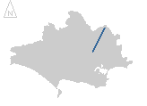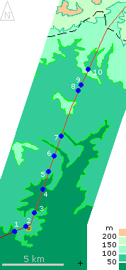
Heights are in metres above sea-level. The cross marks the location of Wimborne, the square the location of Badbury Rings Iron Age hillfort, the dashed-line is the county boundary.
Clicking on a map point will display the photograph taken at that location
|
The photographs show the following:
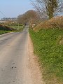
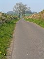
- From Shapwick to Badbury Rings the road follows a route just to the right of the modern tarmac highway (picture)
- At Badbury Rings the causeway (or agger) with drainage ditch either side are visible and follow the line between the farm track and the boundary fence, the outer rampart of the Iron Age fort is visible in the left of the picture, looking back westwards towards Shapwick (picture)
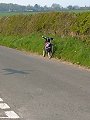
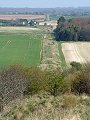
- North from Badbury Rings both drove road ... (picture)
- ...and modern highway follow the nearly 2000 year old route (picture)
- Near Witchampton the modern highway cuts across the Roman road, revealing the raised causeway in section (picture)
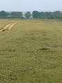
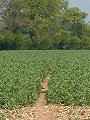
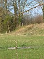
- The causeway is again visible crossing the fields north of Moor Crichel as a slight rise in the field, and a more pronounced dip in the tree-line at the field boundary beyond (picture)
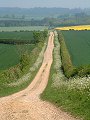
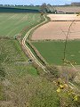
- From Sovel Down the road climbs onto Gussage Down and becomes a clearly defined causeway raised some 1–2m above the surrounding land (picture)
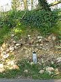
- Near Monkton Up Wimborne the modern highway again cuts through the agger, this time revealing the inner core of chalk and small flint fragments covered with a layer of larger flint nodules. A final layer of small flint fragments would then have been used as the running surface. The water-bottle, centre frame, stands 240mm high (picture)
- Across Wyke Down the raised causeway is again prominent, albeit overgrown (picture)
- From the B-road at Handley Down it is easy to follow with the eye as it heads to the county boundary in the distant forest, although this final section is footpath only so cannot be followed on a bike. (picture)
|
Other sites on the web
Romans in Britain: excellent guide to this period in British history, includes page on Roman roads
Ron Wilcox's online texts on archaeology: includes chapters on the Romans in Britain and life before and after the invasion
Maps of the area on streetmap.co.uk: 1:50,000 – detail,
1:250,000
– locality and route to get there

The pictures of Ackling Dyke in this gallery were captured at high resolution.
This is images of dorset stock photography gallery 060
All photographs copyright © 1998–2003 John Allen
|