Search:
Tarrant Valley
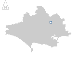
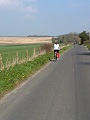
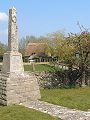
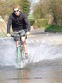
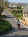
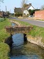
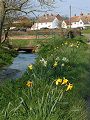
Descending just 55m over its 12km length from Tarrant Gunville (ST 926 128) to where it joins the River Stour at Tarrant Crawford (ST 915 033), the Tarrant Valley is typical of the gently undulating landscape that has developed on the chalk of the eastern side of the county. The cycle ride in March shown in this gallery follows the quiet lane that runs along the length of the valley bottom, the route ascending gently, passing through the many small Tarrant villages before climbing onto the chalk down at Stubhampton (ST 920 135).
|

|
|
|
|
|
|
|
|
|
|
To view any image full size - simply click on the thumbnail
| ||||
A question in popular local pub quizzes is to ask people to name all of the Tarrant villages in the Tarrant valley – in ascending order – the answer being: Tarrant Crawford, Tarrant Keyneston, Tarrant Rushton, Tarrant Rawston, Tarrant Monkton, Tarrant Launceston, Tarrant Hinton, Tarrant Gunville.
Find out more ... |
|
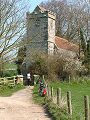
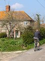
In the top row of pictures:
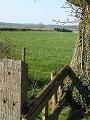
In the bottom row of pictures:
A major annual event at Tarrant Hinton: the Great Dorset Steam Fair Nearby locations that also feature in galleries on this site:
More views of Dorset in March Other sites on the webTarrant Rushton Airfield – well illustrated history of the airfield from 1943–1980 by Andrew Wright The Dorset Page: – local information and links to further resources on the web
Maps of the area on streetmap.co.uk: 1:50,000 – detail, 1:250,000 – locality and route to get there
|